We are guided by what unites people


News
Articles
Media
Announcement
Technology
About Us
Contacts
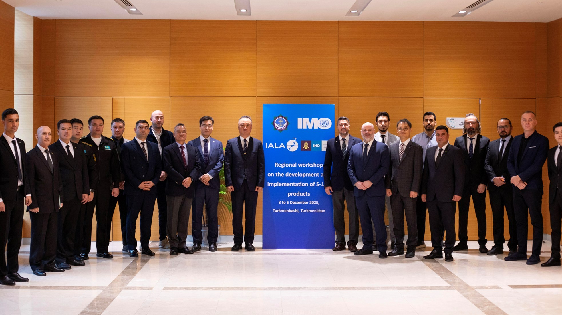
Maritime officials from the littoral States of the Black and Caspian Seas have completed the first regional workshop focused on preparing for the mandatory shift to S-100 digital navigation products. The landmark event, held in Turkmenbashi, Turkmenistan, from December 3 to 5, was co-organized by the International Maritime Organization (IMO) in collaboration with the International Hydrographic Organization (IHO) and the International Association of Marine Aids to Navigation (IALA).
The primary goal of the workshop was to raise awareness about the IHO’s S-100 Universal Hydrographic Data Model and its related products, a crucial component of IMO’s e-navigation strategy.
The Mandate for Modernization
Eighteen government officials from maritime administrations and hydrographic offices in Azerbaijan, Georgia, Kazakhstan, Türkiye, and Turkmenistan attended the event.
The S-100 standard is designed to revolutionize how ships access and utilize navigational information. It acts as a single, interoperable framework that brings together various data types—including depth, currents, tides, and weather—into systems like ECDIS (Electronic Chart Display and Information System). This modernization significantly helps seafarers make better-informed decisions, thereby enhancing safety at sea.
The shift to this new framework is imminent and mandatory:
Revised performance standards for ECDIS, adopted by the Maritime Safety Committee in 2022 and updated in 2024, require the phased implementation of the S-100 framework for all ECDIS equipment installed on or after 1 January 2029.
Fostering Regional Interoperability
Participants used the seminar to share updates on the current status of their hydrographic, navigational, and metrological services. Critical discussions focused on addressing the gaps between current capabilities and forthcoming S-100 requirements, specifically covering the production, dissemination, and management of compliant navigational data.
Officials gained a comprehensive understanding of S-100 requirements, including:
The development of Electronic Navigational Data Services (ENDS).
The dissemination of dynamic information such as navigational and weather warnings.
The interoperability of data streams essential for ECDIS.
The success of the workshop promotes regional cooperation and lays the essential groundwork for a harmonized compliance framework that supports the development and implementation of S-100 products among these strategically important littoral States.
ORIENT
